 Correo Electrónico
 DNINFOA - SIA
 Bibliotecas
 Convocatorias
 Identidad UNAL


"In all prehistoric cultures, solstices and equinoxes were linked to planting and harvesting. For the Muiscas, this was implemented by recognizing the geography which formed a profound symbiosis between the settlements, geography, and the skies. This enabled them to infer their idea of habitat," said Universidad Nacional de Colombia (UNal) Professor and Architect Pedro Juan Jaramillo.
For instance, precisely certain sunlight beams that fall on the Plaza de Bolívar were determinant to build the structure of power of the supreme cacique (chieftain) or Zipa who reigned these lands.
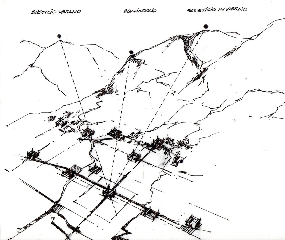
Furthermore, the projections of the Sun established the highest points of the eastern hills or those that filtered through the defiles determined the plazas of the municipalities of Facatativá, Funza, Subachoque, and Chía, among others.
An interdisciplinary research project headed by Jaramillo verified that it was Muisca cosmology and not Spanish elite socio-politics interests which helped found these cities, which later turned to be determining to build the first urban centers.
"Cosmology was also used to design the outlines and establish borders, trails and bridges which link to the most significant elements of the geography of Cundinamarca and Boyacá. A peasant legend near the Guatavita lagoon was the reason of the research project. The legend says that a ray from the Sun which passed across the hills of Monserrate and Guadalupe showed the entrance to El Dorado," said Jaramillo.
Therefore with the purpose of providing academic sustenance to the story, researchers began gathering data on myths, legends and narratives of the chronicles of the New Kingdom of Granada during the conquest. They also analyzed geomorphological aspects of the savannah. Later they examined the solstice and equinox dates for Bogotá and astronomical data for pre-Columbian cultures.
The Power of the Sun
Then they observed and described the interactions between significant geographical aspects such as mountain tops, defiles and the movement of the Sun and the Moon.
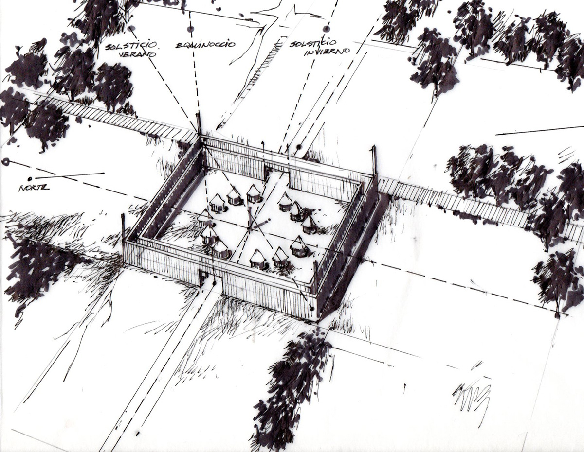
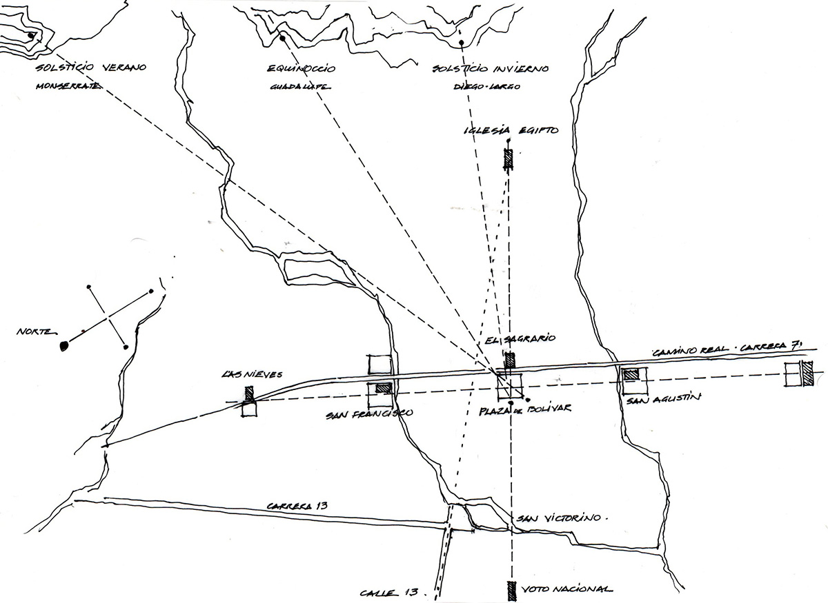
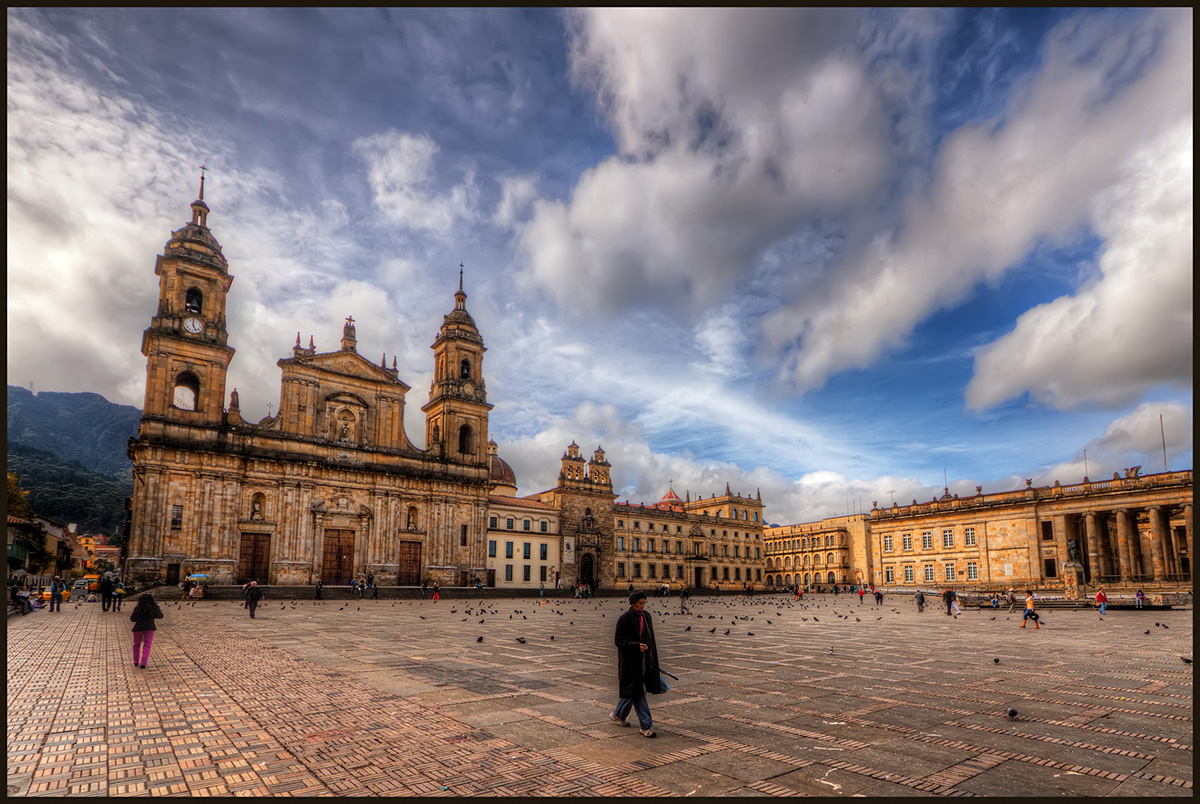
They discovered that Monserrate Mountain interrupts the Sun during the summer solstice (between June 21 and 23) and a beam of sunlight is directed exactly to the northeastern corner of the Plaza de Bolivar from the Primatial Cathedral of Bogotá to the southeastern corner of the Plaza to the Archbishops Palace.
Then on the equinoxes (spring on March 21st and autumn on September 21st) the beam of sunlight goes from the northeastern corner to the medial point of the western side of the plaza, exactly in front of the door to Liévano Palace (current office of the Mayor of Bogotá).
If the ends marked by the lights are joined they form an ellipse over the square of the Plaza de Bolívar, proving the importance of this location for the Muiscas.
The governance structure of the Zipa was guided by a line, also marked by the Sun, which central point was in Funza and the extremes were in Facatativá, to the west and the enclosure located on the Plaza de Bolívar, to the east.
"Although center command of the Zipa was Funza, he was compelled to move towards the Plaza de Bolívar during the rainy season," said Jaramillo.
In fact, the Muisca population was built very close to the eastern hills because the rest of the savannah was surrounded by marshes.
The constant flooding would explain the reason for Gonzalo Jiménez de Quesada, (the founder of Bogotá) who initially arrived to Funza, to move east and get established on what was called the Plaza of Herbs, known today as Santander Park (Carrera 7ª with Calle 16).