 Correo Electrónico
 DNINFOA - SIA
 Bibliotecas
 Convocatorias
 Identidad UNAL


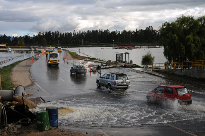

This was the observation made by Juan Manuel Moreno, from the Research Group on Geomorphology and Fluvial Processes of the Geosciences Department of Universidad Nacional de Colombia. "The river"s hillside, due to its morphological characteristics, is designed by its own dynamics as a tributary with many curves that generate flood spots with higher frequency and intensity; during the last 20 years, this fluvial valley has been filled with constructions such as residential complexes and infrastructure of all kinds," asserted the expert.
According to the specialist, for building the landing strip of El Dorado airport, for instance, the tributary of the river was changed and the landing strip is on what used to be the river"s tributary. "They moved it with the authorization of the Government, generating a new channel. Today, we can see how the second strip and the navigation systems are flooded because they are on terrains that used to be the riverbed. Then, people ask, Why does this happen" Simply because that is the way in which we built and design. Where are the control entities that are in charge of this", asked the researcher.
He also mentioned that in the country people think about solutions but when problems arise, there is no prevention. He also explained the way in which investments are made on the Mississippi, the longest river in the US, where floods are also common, to monitor and study its behavior in order to create mitigation and prevention labors before the floods occur.
One of the possible solutions, asserted Moreno, is designing dams in the highest part of the river to accumulate water and then slowly releasing it. This method is similar to that used on Tunjuelito River, where Canta Rana Dam was built, mitigating the effects of floods in several neighborhoods in the sector of Ciudad Bolivar. However, the main measure to be taken is to stop the constructions on river planes, asserted Moreno.