 Correo Electrónico
 DNINFOA - SIA
 Bibliotecas
 Convocatorias
 Identidad UNAL


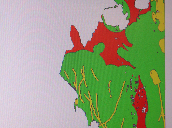
A group from Georrecursos, Mineria y Medio Ambiente (Gemma) at Universidad Nacional de Colombia in Medellin is working on this ambitious project that aims, in long term, to cover the whole country.
The atlas contains a variety of information about physical, environmental and technical aspects; in addition, it includes detailed data about geological aspects, mining, fauna and flora and even sacred places, for instance in Chocó.
"It also shows all the areas the government has designated for negritude. We want to cover all possible variables that help us analyze the potential a territory has to develop, or the potential certain elements have to develop in some areas," explained Óscar Andrés Hortúa, researcher of Gemma group.
According to Hortúa, for the moment, the atlas is being developed in places where the research group is conducting different projects such as the carboniferous region of Amagá in Urabá Antioqueño and the district of Altavista in Medellín and in the "Departamentos" Cesar and Chocó.
"We are making the atlas for each of those regions. We will keep collecting data when the group develops projects in different regions in the country to strengthen the information source the atlas is," said the researcher.
The Information is collected in software. So far, the territories with the most information collected are Chocó and Urabá. According to Gemma group, this project will be an instrument for planning both the project feasibility study and the achievability level, depending on the information level scale that is included in the atlas.
"In this moment we have scale information 1 in 100 thousand in each project, which is really helpful when making decisions about the project feasibility level," explained Hortúa.
The atlas will be available for the public and private sector, as well as for NGOs.
Sedes